Background
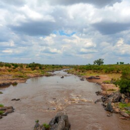
The RUVUMA Transboundary Basin is named after the RUVUMA River (Rio Rovuma) shared between Malawi, Mozambique and Tanzania.
The main Ruvuma River flows along the border between Mozambique and Tanzania. Mozambican territory covers 100,000 km2 (~65%), while Tanzania covers 52,000 km2 (~34%). The remaining part of Malawi covers 2,500 km2 (<2%). In Tanzania, the basin partially covers three regions, 4% of which lies in Lindi, 75% in Ruvuma and 21% in Mtwara. In Mozambique, it covers two provinces with 85% in Niassa Province and 15% in Cabo Delgado Province.
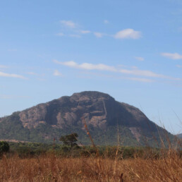
The western part of the basin is the only area with mountains and high altitudes.
Further east, towards the Indian Ocean, the basin is characterised by a plain topography even if no widespread floodplains can be seen as in many other rivers in Mozambique. The upper part of the river basin, Upper Ruvuma, is dominated by dense forests and woodlands with some patches of cultivation evident in the northern sections of the sub-catchment.
As one moves in a south-easterly direction, the land cover transitions into a mosaic of shrubland and woodlands. Most of the cultivation in this catchment occurs in the Tanzania portion of the river basin. Mangroves can be found at the mouth of the Ruvuma River with some coastal forests located further inland, south of the Ruvuma River.
Demographic
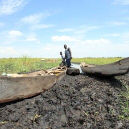
The Ruvuma River Basin is a sparsely populated basin with the largest administrative and commercial centres in Lichinga and Songea in Mozambique.
In Tanzania, 90% of the population lives in rural areas and 10% in urban areas, while in Mozambique, 67% live in rural areas and 33% in urban areas. The population is made up of subsistence farmers and fishermen, dependent on the Ruvuma River and its effluents for their livelihoods. In Mozambique, following the peace agreement in 1992, the population has moved back to their original towns and villages, and the initial restoration of the local economy and new development initiatives have attracted additional people.
Empowering Communities, Building Futures
By valuing local knowledge and fostering a sense of stewardship, we enable communities to thrive while preserving their cultural heritage.
Livelihoods
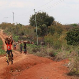
The Ruvuma River Basin has abundant water resources, but access to safe drinking water is poor due to a lack of infrastructure.
Access to sanitation is also poor, with over 90% relying on on-site solutions. The health situation is mainly affected by waterborne diseases, malaria, and malnutrition. Poor communications, poor water supply, poverty, poor rural health services, and malnutrition are contributing factors to poor health. Agriculture is the main source of income for the economically active population, but poverty incidences are high.
Vulnerability
Vulnerability within the Ruvuma River Basin is related to water-related disasters such as floods, droughts, deforestation, food insecurity, waterborne pollution and associated public health hazards.
It is both acute and chronic, with most of the top 10 diseases and causes of death being water-related. There is a lack of improved sanitation facilities and knowledge of the relationship between water, hygiene and excreta disposal. Deforestation is the main source of losing productive water sources. To make soil and water conservation work properly, a joint approach of all villages surrounding areas of water sources is needed.